MAPS FOLIO: AUTOSARCOPHAGY: NEW ORLEANS MAPS (A SELECTION) Laura Vena
I lived for five indescribable years in the city of New Orleans, long before the devastation of its flooding following Katrina, but after it had been ravaged by many other catastrophes of both man and nature. I spent my time there navigating its culture, its incongruities, and its streets, voraciously trying to reconcile the chasm between my fantasies of it and the reality I was living, and trying in folly to trace what has been lost. Now and since, I continue that quest when I go back, and from afar, by poring over vintage maps of the city.
But because maps freeze a particular moment and perspective in time, I found myself wanting to intervene upon the confines of time, space, and political position depicted in the maps. I did so by imposing past and future upon the documents in the most overt way possible: with post-it notes and hand-rendered scribbles. This is almost all reclaimed text, superimposed on maps, post-its, and captions. It's an act of collaging, of assemblage, of tracing the stories of a city, the stories imposed on a city, and layering them one on top of another in an attempt to welcome simultaneous and conflicting perspectives, and to reflect the impossibly synchronous nature of time in New Orleans. Although not all the interventions reflect my personal experience of the city, they are still personal. They represent my attempt to comprehend why the city always feels so haunted.
Click for larger images.
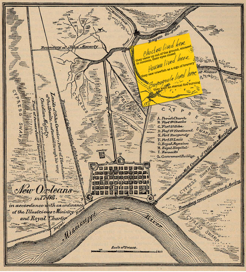
2. With each landing of immigrants in and around New Orleans, the Indians were pushed farther southeast. As their numbers dwindled, they banded together and eventually all Indians in the area became the Houma tribe. Early Europeans in Louisiana tried to enslave the Indians, but were unsuccessful. They desired a source of free labor to make the territory profitable, and the first enslaved Africans appear in the German Coast census of 1731.
Original Map: New Orleans in 1798 in accordance with an ordinance of the Illustrious Ministry and Royal Charter, Report on the Social Statistics of Cities, Compiled by George E. Waring, Jr., United States. Census Office, Part II, 1886
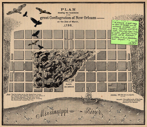
5. The Great New Orleans Fire of March 21, 1788, also known as The Good Friday Fire, started about 1:30 p.m. at the home of Army Treasurer Don Vincente Jose Nunez, at 619 Chartres Street at Toulouse Street, less than a block from Jackson Square (or the Plaza de Armas, as it was known then and as it’s referred to on the map). Within five hours, the conflagration consumed almost the entire city, fed by a strong wind from the southeast, destroying 856 of the city’s 1,100 structures. As a colony of Spain, rebuilding was done in the Spanish style, and most French architecture was erased from the French Quarter.
Original Map: New Orleans, Louisiana 1788 “Plan showing the boundaries of the great Conflagration of New Orleans on the 21st of March, 1788.” From Report on the Social Statistics of Cities, Compiled by George E. Waring, Jr., United States. Census Office, Part II, 1886.
_____
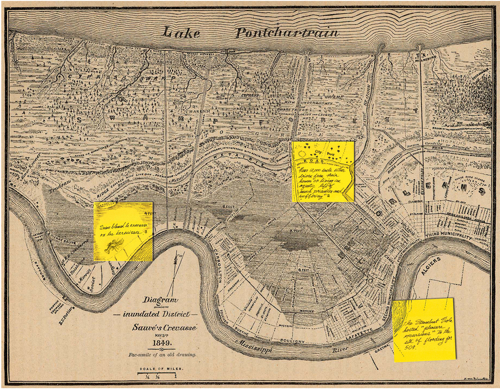
1 Excerpt from Governor Esteban Rodriguez Miró y Sabater’s account of the fire.9. Sauvé's Crevasse was a Mississippi River levee failure that flooded much of New Orleans in 1849. Some seventeen miles up river from the city, in Jefferson Parish lay a plantation belonging to Pierre Sauvé. There, on the afternoon of May 3d, the levee gave way. Most of what is now Uptown New Orleans and the New Orleans Central Business District were badly flooded. For weeks the efforts to close the crevasse had proven unavailing. Then two engineers, George T. Dunbar and Surgi, undertook the task, and with carte blanche as to methods and materials, succeeded after seventeen days of heroic exertion, in staunching the flood on the 20th of June. The waters, however, did not disappear till nearly a month later.
Original Map: New Orleans, Louisiana 1849 “Diagram showing the inundated District Sauvé's Crevasse May 3rd 1849. Fac-similie of an old drawing.” From Report on the Social Statistics of Cities, Compiled by George E. Waring, Jr., United States. Census Office, Part II, 1886.
_____
2 Excerpt from Waring & Cable’s Social Statistics of Cities, Reports on New Orleans
3 Crevasse: a deep fissure; les ecrevisses: the crawfish
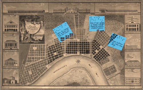
27. The Choctaws and other Native Americans would collect pecans, hide them in holes, wear them around their necks and carry them in leather pouches. Sometimes if you dig up on the cemetery hill, you can find small stores of rancid pecans in shallow graves.
Original Map: Plan of the city and suburbs of New Orleans: from an actual survey made in 1815, by I. Tanesse ; Rollinson, sc.
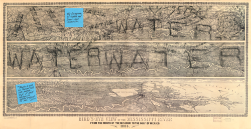
38. Map embellished with original rubbings of New Orleans’ various vintage sewer covers, composed from precarious positions in the middle of nighttime streets with Candy Ellison.
Original Map: Bird's-eye view of the Mississippi River: from the mouth of the Missouri to the Gulf of Mexico, 1884, drawn & engraved by Edward Molitor, T.E
_____
5 Sentiments of a lifelong 9th Ward inhabitant after the flooding that followed Katrina.

